
The US Navy is set to use Esri's advanced location intelligence technology with its unmanned vehicles to enhanced the systems' operational intelligence.
The deployment will mark the first use of Esri technology by the US Navy, and is intended to enable the maritime remote vehicles to optimise the process of gathering significant locational data prior to ocean and near-shore operations.
Go deeper with GlobalData

Discover B2B Marketing That Performs
Combine business intelligence and editorial excellence to reach engaged professionals across 36 leading media platforms.
Esri’s mapping and analytics will enable information collected from unmanned vehicles to be incorporated into the navy’s activities to facilitate improved operational intelligence.
It will help US Navy commanders make faster tactical decisions and better incorporate environmental conditions into strategic plans.
Esri chief scientist Dawn Wright said: “The use of Esri’s platform represents a huge improvement in the operational impact of data collected by unmanned marine systems.
“We look forward to delivering critical situational awareness for the US Navy during missions. Never before has ocean-based reconnaissance intelligence been both authoritative and available in near real-time.”

US Tariffs are shifting - will you react or anticipate?
Don’t let policy changes catch you off guard. Stay proactive with real-time data and expert analysis.
By GlobalDataEsri software uploads sensor data from the unmanned vehicle systems into a command centre, where it can then be comprehended completely and faster than ever before.
The technology will ultimately help combine US Navy data with structured analysis to help personnel make better-informed decisions.
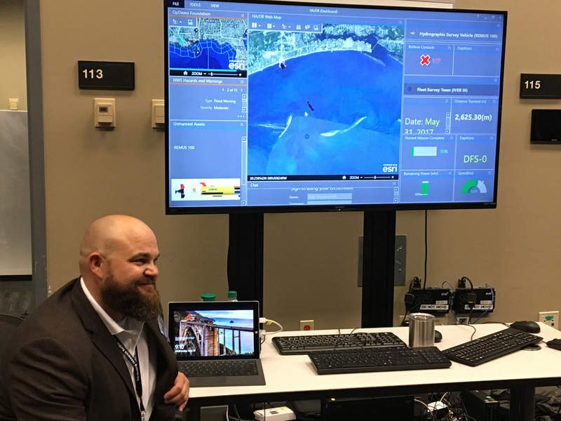
The Naval Meteorology and Oceanography Command (NMOC) hosted an 'Unmanned System Operational Demonstration' off the coast of Gulfport, Mississippi last week.
NMOC commander and US Navy rear admiral Timothy Gallaudet said the demonstration sought to "demonstrate naval oceanography’s environmental support capability for Fleet and Joint unmanned systems (UxS) operations."
The command will be able to assess information gathered from the ocean in near real-time, such as water temperature, humidity, wind speed and topography.
Image: With Esri's software, NMOC can analyse data collected from the ocean. Photo: courtesy of Esri.