
Katie Woodward: Please could you tell us about the technology you will be trialling at Unmanned Warrior – its capabilities, features, applications.

Discover B2B Marketing That Performs
Combine business intelligence and editorial excellence to reach engaged professionals across 36 leading media platforms.
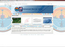
Esri UK: This year’s Unmanned Warrior exercise is the first ever Royal Navy exercise planned in the cloud. ArcGIS Online is the cloud-based mapping platform from Esri UK, the leading provider of geographic information systems (GIS) to the UK MoD and Armed Forces, and is being deployed – as the Unmanned Warrior portal – to provide real-time collaborative planning capability, COP and data exploitation environment for this complex real-world exercise.
KW: How will your technology help the Royal Navy and others in their activities?
Esri UK: The three main elements are planning, deployment and post deployment.
Planning: ArcGIS Online is being used by the 50+ participating organisations to view and contribute to the plan, collaboratively, from their own office location and at times of their choosing. All planning is done online, without the need for spreadsheets, charts or PowerPoint.

US Tariffs are shifting - will you react or anticipate?
Don’t let policy changes catch you off guard. Stay proactive with real-time data and expert analysis.
By GlobalDataFor example, flagging up air zones and general weather conditions, which may affect the plan, will allow for that day’s plan to be refined, after which it can be published and shared with all stakeholders as the approved plan for the day.
Deployment: ArcGIS Online and Operations Dashboard will be used to monitor and report on the progress of the exercise, from multiple locations, based on near real-time data feeds. Data exploitation will play a key role in the exercise’s success.
Esri UK will host an exploitation hub where all information outputs will be published through the Unmanned Warrior portal. For example, 3D terrain visualisation from a UAV out at sea will help to guide planners as to what data they are collecting.
Post deployment: ArcGIS will be used for the storage, management, processing and exploitation of data gathered during the exercise. Esri UK anticipates that further analysis of data captured during Unmanned Warrior may be used in Information Warrior (due Q1 2017). The results of this data exploitation will be disseminate in a controlled manner and made available in the necessary formats to approved participants and stakeholders.
KW: How important is autonomy for the maritime defence industry?
Esri UK: It is becoming increasingly important because, as the capability of autonomous vehicles (air, surface and sub-surface) increases, the costs are reducing. The resulting benefits fall into two main categories.
- The relative cost-effectiveness of these autonomous platforms means that the maritime defence industry will be able to deploy more of them, and thereby collect more data. More data delivers more value by giving additional insight and a richer picture of any situation, so enhancing operational awareness.
- The increasing capabilities and resilience of these platforms means that operations can be undertaken at reduced risk, e.g. mine countermeasures (MCM) and surveillance.
These benefits are essential in establishing and maintaining information and operational superiority during a time when there is pressure to manage costs.
KW: Are you working on any future autonomous systems?
Esri UK: We are currently working on a European Space Agency research programme planning coordination of UAVs, with ViaSat and the Swiss company ELCA. The aim of the programme is to look at how UAVs can offer new services and applications beyond traditional aviation, in a more affordable and environmentally friendly way.
KW: What do you hope to gain from participating in Unmanned Warrior 2016?
Esri UK: We enjoy a long-term relationship with the Royal Navy and Unmanned Warrior has given us the opportunity to demonstrate how cloud-based geo services can effectively plan and coordinate a major exercise with over 50 participating organisations, without the need for any printed charts or spreadsheets.
Commander Peter Pipkin, the Fleet Robotics Officer, commented: “The use of ArcGIS Online is a significantly different way of planning for us, so the opportunity to explore its utility in the unique construct of Unmanned Warrior is a chance that we wanted to fully exploit.”
“The use of ArcGIS Online in the planning of Unmanned Warrior demonstrates how Portal for ArcGIS – the implementation of ArcGIS Online in a customer’s own secure environment – could be a game-changer in operations planning for tactical exercises and for deployed operations,” said Adrian Friend, head of defence national security and public safety at Esri UK.
“We look forward to showing how GIS underpins the operation of unmanned platforms and sensors, and the exploitation of their data, to deliver critical situational awareness during Unmanned Warrior.”
Fundamentally our intention is that by participating in Unmanned Warrior in an innovative manner, we will further strengthen our relationship with the Royal Navy and wider MoD. It is essential to us that we demonstrate an ability to innovate and that whatever capabilities we offer are “real”; can be deployed in a timeframe to meet need; and that they deliver tangible and sustainable benefits to the Royal Navy.


