
The US Defense Advanced Research Projects Agency (DARPA) has revealed a new programme known as the Ocean of Things, which aims to expand maritime situational awareness over large ocean areas.
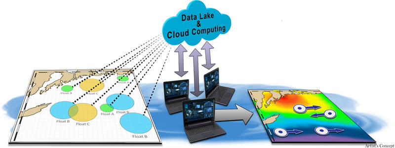
DARPA intends to use the programme to enable continuous maritime awareness over wide-ranging ocean areas by deploying several small, low-cost smart floats in order to develop a distributed sensor network.
Go deeper with GlobalData

Each smart float would comprise a range of commercially available sensors to gather environmental data regarding ocean temperature, sea state and location, in addition to activity data about commercial vessels, aircraft and maritime mammals moving through the region.
The floats would be capable of periodically transmitting data to a cloud network via satellite for storage and real-time analysis purposes.
DARPA Strategic Technology Office programme manager John Waterston said: “The goal of the programme is to increase maritime awareness in a cost-effective way.
“It would be cost-prohibitive to use existing platforms to continuously monitor vast regions of the ocean.
“By coupling powerful analytical tools with commercial sensor technology, we plan to create floating sensor networks that significantly expand maritime awareness at a fraction of the cost of current approaches.”
However, DARPA’s Ocean of Things is expected to face technical challenges in the areas of float development and data analytics.
Under the float development phase, proposers will need to design an intelligent float featuring a passive sensor suite that can survive in harsh maritime environments.
Each float would report data from its surroundings for at least one year before safely sinking itself in the deep ocean.
The floats should be made of environmentally safe materials that pose no danger to vessels, while complying with all federal laws, regulations and executive orders related to the protection of marine life forms.
Furthermore, the data analytics portion of the project will require participants to develop cloud-based software solutions and analytic techniques to process the floats’ reported data.
The development is expected to comprise the dynamic display of float locations, health and mission performance, in addition to the processing of environmental data for oceanographic and meteorological models.
The initiative will also require the development of algorithms to automatically detect, track and identify nearby vessels, as well as the identification of new indicators of maritime activity.
