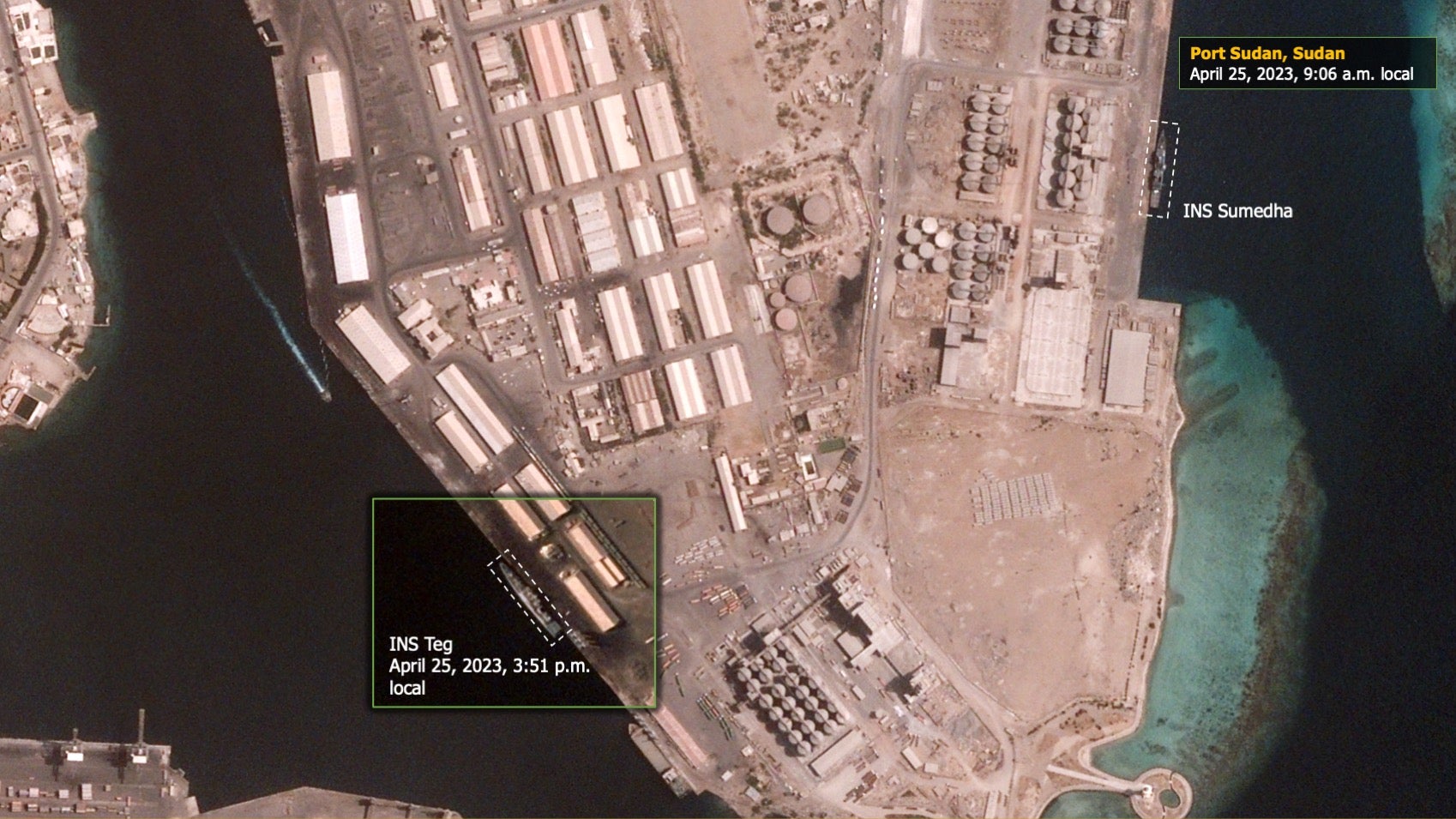
Naval technology has received exclusive satellite imagery from BlackSky of Operation Kaveri, the India’s evacuation of its nationals from Port Sudan using the Saryu-class patrol vessel INS Sumedha and the Talwar-class frigate INS Teg, yesterday on 25 April.
With clashes in Sudan between Sudanese armed forces and the paramilitary Rapid Supply Forces, nations have been in a race to evacuate their citizens from a rapidly deteriorating security situation. A US brokered 72-hour ceasefire began midnight 24 April to allow for the evacuation.
Some 278 Indian Nationals successfully escaped on the Sumedha while the Teg arrived to provide relief supplies and additional assistance to Indian nationals. Around 3000 Indian nationals were estimated to be in Sudan as violence gripped the country, with 500 relocated to the Port of Sudan in anticipation of rescue. A further 283 Indian nationals have been evacuated across two IAF C-130J flights from Port Sudan Airfield today.
BlackSky are a geospatial intelligence company with a constellation of 14 fast response satellites orbiting along the Earth’s equator, that can surface requests for imagery within 90 minutes. The low-latency network is renowned for its automated image collation across thousands of sites worldwide that can be directed from any cellular device, with applications for battlefield operations. Using outside data feeds to indicate locations for collation, BlackSKy can tip its satellites to automatically monitor incoming and outgoing maritime or air traffic using transponder signals, such as the arrival of ships at Port Sudan.
The imagery obtained shows the points where vessels from the Indian Navy moored at the Port Sudan during the operation Kaveri. The main image is from 9:06am local time, and shows the Saryu-class patrol vessel INS Sumedha at port before it departed with Indian nationals aboard. A supplemental image from 3:00pm local time shows the Talwar-class frigate INS Teg which had arrived at about midday, according to an independent analyst with knowledge of the site.
These automation processes can also be used to cue image collation based on seismic events, and with this approach BlackSky returned the first Satellite images of the devastating explosion in Beirut on 4 August 2020. Input feeds from thermal sensors have also been used in Ukraine to direct the satellites to areas where military activity is thought to have occurred.


